Climbing Mount Kenya: Routes, Cost, and Travel Guide
Mount Kenya National Park requires Kenya Wildlife Service permits, which cost $52 per person per day for non-residents. Guided climbs run $800-$1,500 depending on route and group size. Peak climbing season runs January-February and August-September when weather windows are most reliable. Stay connected during your trek with an eSIM for Kenya to share updates and access trail maps.
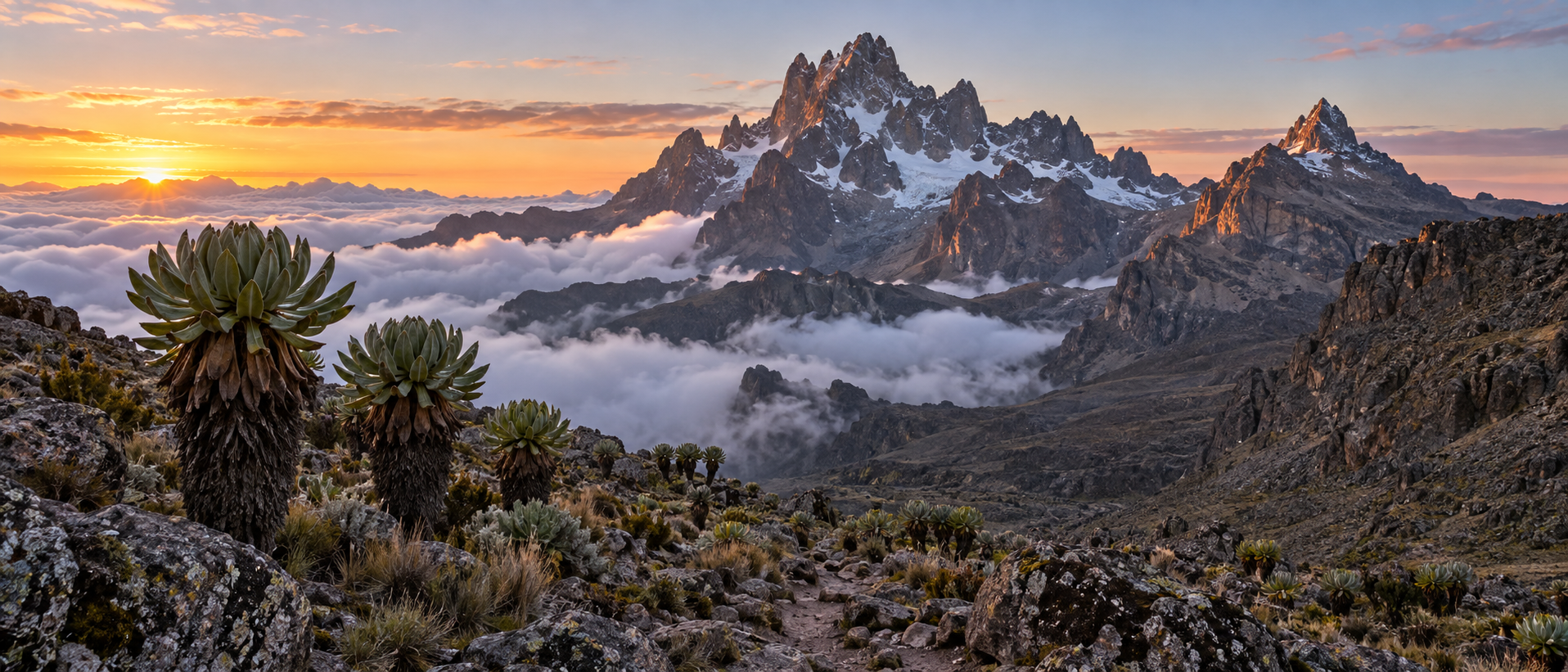
Mount Kenya combines high-altitude trekking routes to Point Lenana with technical climbing on Batian and Nelion.
Technical climbs to Batian (5,199m) and Nelion (5,188m) require mountaineering experience, ropes, and multi-day rock and ice climbing. This guide covers route selection, acclimatization strategies, gear requirements, and permit logistics for both trekking and technical ascents.
Standard routes take 4–6 days. The Sirimon-Chogoria traverse covers roughly 60 kilometres and is considered moderate, while the steeper Chogoria route ascends quickly through bamboo forest and moorland. Altitude is the primary challenge: most climbers experience mild symptoms above 4,000 metres, and acclimatisation days significantly improve summit success rates.
Temperatures range from 15°C at trailheads to -10°C near the summit. Snow and ice are present year-round above 4,600 metres. The Kenya Wildlife Service manages permits and park regulations. Staying connected during your trek is practical with an eSIM for Kenya, as Safaricom coverage reaches base camps on most routes.
Batian (5,199m) and Nelion (5,188m) are technical peaks requiring rock climbing experience, ropes, harnesses and helmets. These summits demand Grade IV to V climbing skills and are typically attempted only by experienced mountaineers with guides certified by the Kenya Wildlife Service.
The 200-metre altitude difference between Lenana and Batian is significant: Lenana's final approach is a steep but walkable scramble, while Batian's Diamond Couloir and Gate of Mists routes involve exposed rock faces and ice climbing. If you're trekking to Point Lenana, consider bringing an Airalo Kenya eSIM for emergency contact—mobile coverage reaches base camps at 3,000–4,200m on most routes.
Three main trekking routes reach Point Lenana at 4,985 metres, each offering distinct scenery and difficulty profiles. Sirimon approaches from the northwest through dry forest and moorland, gaining altitude gradually over 4–5 days with the gentlest gradient. It's the most popular choice for acclimatisation and connects well with descent via Chogoria. Chogoria ascends the eastern flank through bamboo forest and past Lake Michaelson, widely considered the most scenic route but steeper in sections. Most climbers use it for descent after summiting via Sirimon. Naro Moru is the shortest and steepest, climbing the western side through the infamous Vertical Bog—a knee-deep mud section that can be exhausting. It reaches the summit in 3 days but offers less time to adjust to altitude, increasing the risk of mountain sickness.
Book permits and arrange guides through the Kenya Wildlife Service, which manages Mount Kenya National Park. Staying connected during your climb is essential for safety updates and coordination—an eSIM with reliable coverage ensures you can reach emergency services if needed.
Climbing Mount Kenya to Point Lenana (4,985 m) demands good cardiovascular fitness but no technical mountaineering skills. Most trekkers rate the difficulty as moderate to challenging, with the main obstacles being altitude, cold night temperatures dropping to −10°C, and steep scree sections on summit day. You should be comfortable hiking 5–7 hours daily with a daypack, often on uneven terrain above 4,000 metres.
Acclimatisation is non-negotiable. Acute mountain sickness (AMS) affects roughly 75% of trekkers who ascend too quickly. A minimum four-day itinerary with gradual altitude gain—sleeping at 3,300 m on night one, 4,200 m on night two—reduces risk significantly. The Kenya Wildlife Service recommends five days for the Sirimon or Chogoria routes. Symptoms like headache, nausea and breathlessness warrant an immediate descent. Staying connected with an eSIM for Kenya ensures you can contact guides or emergency services if conditions deteriorate on the mountain.
Most trekkers reach Point Lenana on a 5-day itinerary via Sirimon up and Chogoria down, spending nights at Old Moses (3,300m), Shipton's Camp (4,200m), summiting before dawn on day four, then descending to Minto's Hut (4,300m) and exiting via Chogoria Gate. This route balances acclimatisation with scenic variety.
A 6-day schedule adds an extra night at Shipton's Camp, improving altitude adaptation and success rates for those less confident in their fitness. The additional day reduces the risk of altitude sickness and allows a rest day at high elevation before the summit push.
Seven-day climbs typically use the Chogoria route in both directions or combine all three routes in a traverse. This longer itinerary suits climbers attempting technical peaks like Nelion and Batian, which require rock-climbing skills and an extra day for the ascent. Booking a Kenya eSIM before departure ensures you stay connected with guides and emergency services throughout the mountain trek, even above the treeline where mobile coverage becomes intermittent.
Mount Kenya Climbing Costs, Park Fees and Permits
Budget between $600 and $1,200 per person for a guided Mount Kenya climb, depending on route length and group size. This typically covers park fees, guide and porter wages, meals, camping equipment, and mountain rescue insurance.
Kenya Wildlife Service charges non-residents $52 per person per day for park entry, plus $26 per night for camping inside the park. Kenyan residents pay substantially less. Book permits through Kenya Wildlife Service or arrange them through your tour operator.
Fee | Non-resident cost |
|---|---|
Park entry | $52 per person per day |
Camping inside the park | $26 per night |
Non-resident park entry and camping fees charged by Kenya Wildlife Service.
Additional expenses include:
Mountain guide: $30–$50 per day (mandatory above 3,200m)
Porter: $15–$25 per day per porter
Park gate transfers from Nairobi: $150–$200 return
Gear rental (sleeping bag, trekking poles): $5–$10 per item per day
Mount Kenya has two dry seasons ideal for trekking: January to mid-March and late June to October. These windows offer stable weather, minimal rain, and clearer summit views. January and February deliver the warmest conditions and lowest precipitation, making them the most popular months for Point Lenana attempts.
The long rains (April–May) and short rains (November–December) bring afternoon downpours, muddy trails, and reduced visibility above 4,000 metres. While permits remain available year-round through the Kenya Wildlife Service, summit success rates drop significantly during wet months due to snow, ice, and cloud cover on Batian and Nelion.
Check the Mountain Forecast for altitude-specific predictions before departure. Temperatures at Point Lenana (4,985m) range from -10°C at night to 10°C during the day, regardless of season. Pack layers and waterproofs even during dry periods—afternoon storms can appear without warning on all routes.
Stay connected on the mountain with a reliable Kenya eSIM for real-time weather updates and emergency communication.
Kenya Wildlife Service requires trekkers attempting Batian or Nelion to hire a certified mountain guide; Point Lenana climbers are strongly advised to do the same. Guides cost $20–30 per day, porters $15–20. Most operators include guides in package rates. Book through Kenya Wildlife Service or vetted outfitters registered with the Kenya Professional Safari Guides Association.
Essential gear includes a four-season sleeping bag rated to -10°C, waterproof jacket and trousers, insulated layers, trekking poles, headlamp, and high-altitude boots. Camps along all routes provide bunkhouse accommodation with basic mattresses; bring a sleeping bag liner for hygiene. Water is available at huts but must be treated. Altitude sickness is the primary risk above 4,000 metres—descend immediately if symptoms worsen. Carry diamox only after consulting a travel clinic. Check real-time weather at Mountain-Forecast.com before departure. Stay connected with an eSIM for emergency coordination at trailheads and lower camps where signal permits.
Most climbers reach Mount Kenya by road from Nairobi. The drive to Nanyuki, the main staging town, takes 3–4 hours (200 km) via the Thika Superhighway and passes through Karatina. Matatus and shuttle services run daily from Nairobi's River Road area to Nanyuki for KES 500–800. From Nanyuki, arrange onward transport to the Sirimon Gate (20 km) or continue to Chogoria village (80 km east) for the Chogoria route trailhead.
Private charter flights land at Nanyuki Airstrip (NYK) from Wilson Airport in Nairobi, cutting travel time to under an hour. Safarilink and AirKenya operate scheduled services. The Chogoria route is also accessible from Meru, reached in 4–5 hours from Nairobi via Embu.
Staying Connected with a Kenya eSIM During Your Trek
An eSIM installed before departure eliminates the need to visit a physical shop in Nairobi or Nanyuki. Load at least 5–10 GB if you plan to share photos, check weather forecasts via services like Mountain-Forecast, or communicate evacuation details in an emergency. Airtel Kenya provides backup coverage in some areas where Safaricom weakens, though penetration above 3,500m remains limited across all carriers.
Download offline maps, trail GPS tracks, and emergency contact details for Kenya Wildlife Service before ascending. Satellite messengers remain the only reliable communication tool above 4,000m.
Yes. Kenya Wildlife Service requires all trekkers to hire a registered guide or join an organised expedition. Solo climbing is not permitted. Guides know the routes, monitor altitude sickness symptoms, and coordinate evacuations if needed. Book through Kenya Wildlife Service approved operators or contact the Mountain Club of Kenya for vetted guide recommendations.
How do I stay connected on the mountain?
Mobile coverage is patchy above 3,500 m and absent near the summit. A Kenya eSIM with Safaricom offers the best reach on lower slopes and in Nanyuki. Download offline maps, share your itinerary before departure, and carry a satellite communicator for emergencies.
What permits do I need?
All climbers pay park entry fees and camping or hut fees directly to Kenya Wildlife Service. Your operator typically arranges permits; confirm this before departure. Fees vary by residency status and are paid in Kenyan shillings or by card at park gates.

Kenya eSIM from $4.99 — Safari eSIM
Unlimited data on Safaricom. Built for safari travelers.
Get Safari eSIM